Aerial Drone Survey – Agriculture Mapping, Crop & Plant Health, Crop Scouting & Drainage Tile Design
Plant Variability, Agriculture Mapping, Crop Scouting & Drainage Tiles
Are you a farmer looking for a crop scouting drone to review crop health with mapping and not sure what data a drone can provide, at Drone Survey Canada we can save you money and time with our Plant Variability Mapping software and expert Drone pilots.
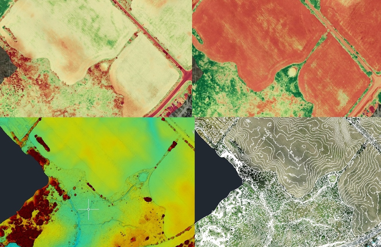
Drone Survey Canada offers Visible Atmospherically Resistant Index Algorithm (VARI) mapping to review your crop health. The software creates a map interpolating the red and green reflections from the plants.
In need of an accurate drainage mapping solution generated from UAV aerial imagery for your agriculture needs? We can provide Digital Elevation Models (DEM), Digital Terrain Models (DTM), Orthographic Mosaic Images, to compliment the crop review survey.
In need of a crop survey, or vegetation review?
Drone Survey Canada can provide agriculture and tile drainage services:
- Visible Atmospherically Resistant Index (VARI)
- Plant Variability Mapping
- Agriculture Mapping for Plant Health
- Point Clouds
- Topographic Survey
- Contour Mapping
- Aerial Drone Survey Tile Drainage
- Tile Drain Plan + Ortho
- Export to CAD & Precision Agriculture Software
- Sediment & Erosion Control Inspection
Contact us at Drone Survey Canada to review your Crop Scouting & Tile Drainage needs.